Severe Thunderstorms Predicted: Updated Timeline and New Details for Connecticut
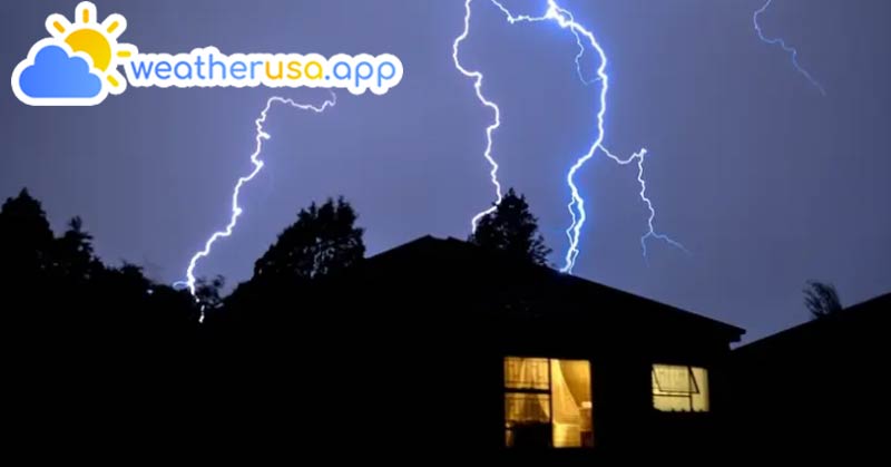
The National Weather Service forecasts that severe thunderstorms are possible in Connecticut starting Friday after 2 p.m. and lasting until around midnight.
Wind gusts could exceed 58 mph in some areas, potentially causing "Scattered power outages". Additionally, damaging hail is possible.
Zipcode in 06010 - Bristol CT
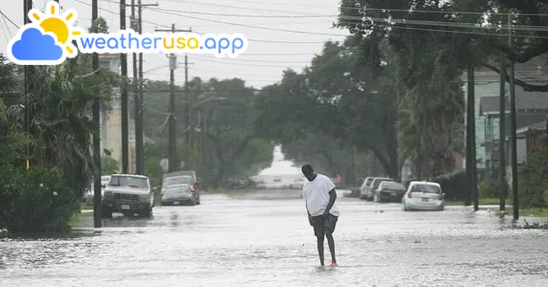
"There remains a low chance of localized flash flooding in any stronger storms", the weather service stated.
"If the threat of severe weather increases, a Severe Thunderstorm Watch may be needed during the day on Friday", the weather service added.

WFSB 3 TV meteorologists have noted, "From the late afternoon into the evening, the likelihood of rain and thunderstorms will increase. We’ve issued a *First Alert* as evening/outdoor plans may be impacted by strong, possibly severe storms. The main concerns are heavier rain , frequent lightning, and gusty winds, with a chance of hail. Storms will begin in NW Connecticut in the late afternoon, exiting SE CT around 11 p.m. Friday".
Father's Day Weekend Forecast
"Behind tomorrow’s cold front, spectacular weather is on tap for Father’s Day weekend. Both days will be dry and bright, comfortably warm with low levels of humidity. We’re forecasting lows between 55 and 60, and highs between 80 and 85", said WFSB 3 TV Meteorologist Mike Slifer.
Heatwave Next Week
See more: Weather forecast in 06006 - Windsor CT
"Following what promises to be an amazing weekend, heat returns next week with a gradual uptick in humidity", Slifer noted. "We’ll likely see temperatures reaching 90° starting Monday . We’re forecasting the hottest weather since last September and our first heatwave of the year. On Monday, highs inland should be near 90° with comfortable dew point values. Tuesday will be several degrees warmer and muggier. By Wednesday and Thursday, it will be downright hot and humid. With the combination of heat and humidity later in the week, we have issued a First Alert from Tuesday to Thursday. During the day, it will feel like 95-104°. At night, lows will be in the 70s, making it difficult to cool down even at night".
Forecast Details for Southern Connecticut (National Weather Service)
Friday:
- A slight chance of showers, then showers and thunderstorms likely after 2 p.m. Some storms could produce heavy rainfall.
- Mostly cloudy, then gradually becoming sunny, with a high near 83.
- Southwest wind 7 to 11 mph.
- Chance of precipitation is 60%.
- New rainfall amounts between a tenth and a quarter of an inch, with higher amounts possible in thunderstorms.
Friday Night:
- Showers and thunderstorms, mainly before 2 a.m. Some storms could produce heavy rainfall.
- Low around 64.
- Southeast wind around 6 mph, becoming light and variable after midnight.
- Chance of precipitation is 80%.
- New rainfall amounts between a half and three-quarters of an inch possible.
Saturday:
- A 20% chance of showers before 11 a.m.
- Sunny, with a high near 81.
- North wind around 10 mph.
Climate and Average Weather in 06002 - Bloomfield CT
Sunday:
- Sunny, with a high near 78.
Forecast Details for Northern Connecticut (National Weather Service)
Friday:
- A chance of showers before 1 p.m., then a chance of showers and thunderstorms between 1 p.m. and 2 p.m., then showers likely and possibly a thunderstorm after 2 p.m. Some storms could produce heavy rainfall.
- Partly sunny, with a high near 86.
- South wind around 9 mph, with gusts as high as 22 mph.
- Chance of precipitation is 70%.
- New rainfall amounts between a quarter and half an inch possible.
Friday Night:
- Showers likely and possibly a thunderstorm. Some storms could produce heavy rainfall.
- Patchy fog between 11 p.m. and midnight.
- Mostly cloudy, with a low around 62.
- Calm wind becoming northwest around 5 mph after midnight.
- Chance of precipitation is 70%.
- New precipitation amounts between three-quarters and one inch possible.
See more: Weather Forecast For 06001 - Avon CT
Saturday:
- A chance of showers before 9 a.m.
- Sunny, with a high near 80.
- North wind 9 to 11 mph, with gusts as high as 21 mph.
- Chance of precipitation is 30%.
Sunday:
- Sunny, with a high near 80.
- North wind around 6 mph, becoming west in the afternoon.